Earth and Space Sciences Regents, June 2026, question 18
Tap an image to open it full size.
What the figure shows
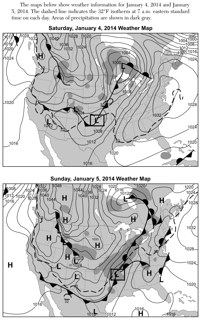
Two weather maps of North America, for January 4 and January 5, 2014, show isobars labelled in millibars (mb), cold, warm and stationary fronts, high pressure (H) and low pressure (L) centers, and areas of precipitation in dark gray. H centers appear in western Canada, the western and central United States, near the Atlantic coast and over the Pacific Ocean. The question asks why weather in high pressure areas is generally clear.
How to think about it
On both maps, look at each H and note what lies around it: fronts, dark gray precipitation, and how close together the isobars are. Then do the same for each L. Recall whether air rises or sinks in each kind of pressure center, and which one makes clouds.
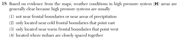
Based on evidence from the maps, weather conditions in high pressure system (H) areas are generally clear because high pressure systems are usually
Choice 1 is right. On both maps the H centers are mostly away from the fronts and the dark gray precipitation areas, which gather around the L centers. Air sinks in a high pressure system, and sinking air warms and dries out, so clouds rarely form. Fronts, where air is forced to rise, belong to low pressure systems.
Fronts on these maps are attached to low pressure centers, not high pressure centers. The direction a cold front's triangles point shows which way the front moves, not where a high sits. This choice may come from reading the front symbols as a location rule.
Warm fronts also extend from low pressure centers, and a high does not sit only near them. Being near any front tends to bring clouds, which is the opposite of clear weather. This choice may come from mixing up front symbols with pressure centers.
Closely spaced isobars show a steep pressure gradient and strong winds, not clear skies. The centers of high pressure systems usually have widely spaced isobars and light winds. This choice may come from mixing up isobar spacing with pressure value.