Earth and Space Sciences Regents, January 2026, question 28
Tap an image to open it full size.
What the figure shows
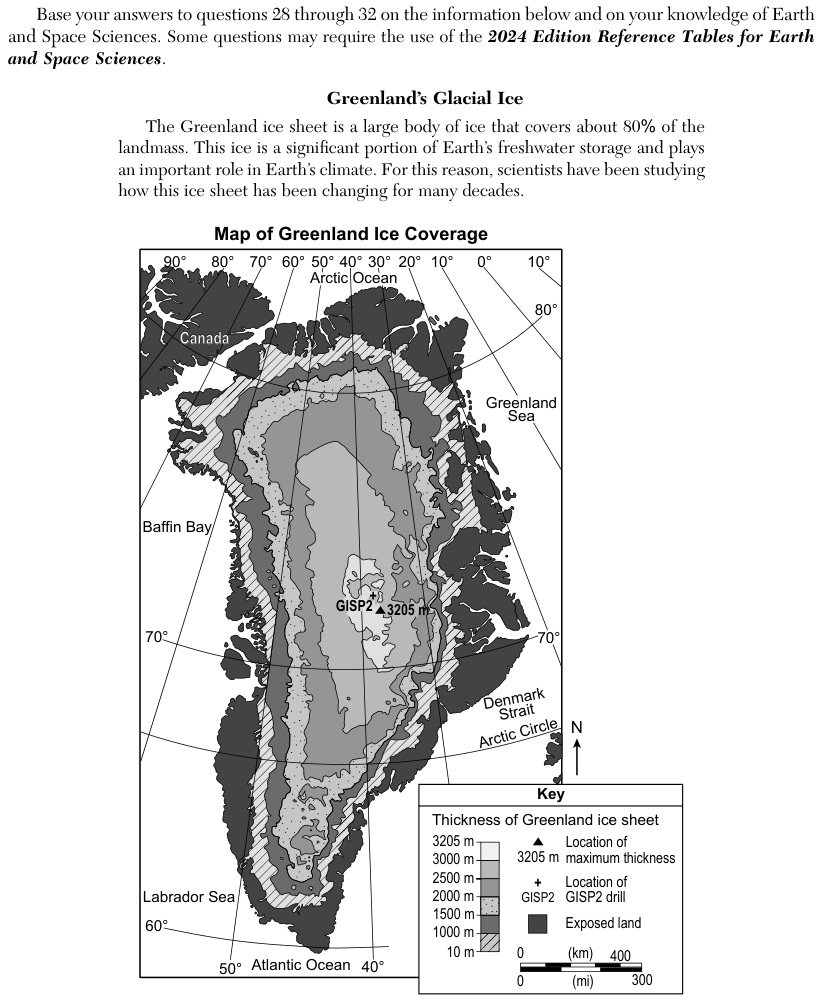
The passage says the Greenland ice sheet covers about 80% of the island and stores a large share of Earth's freshwater. The Map of Greenland Ice Coverage shades ice thickness in bands from 10 meters (m) up to 3205 m, with exposed land shown in solid dark grey. A triangle marks the maximum thickness of 3205 m near the center, beside a cross for the GISP2 drill site. Baffin Bay lies to the west, the Greenland Sea and Denmark Strait to the east.
How to think about it
Start with the map alone. Trace the thickness bands from the center of the island out to the coast and note where the thickest and thinnest ice lie, and where land is exposed. Then think about how air temperature changes from the high center to the low coasts, and check whether each claim links a change in climate to the pattern the map shows.
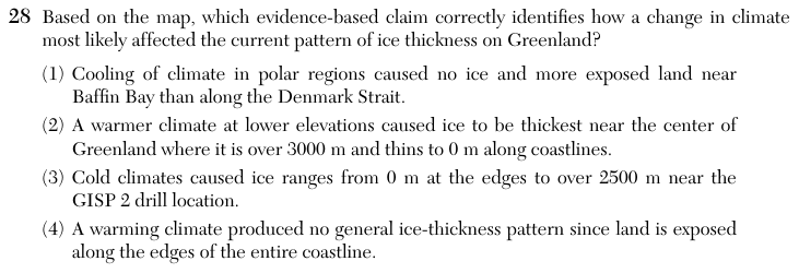
Based on the map, which evidence-based claim correctly identifies how a change in climate most likely affected the current pattern of ice thickness on Greenland?
Choice 2 is right. The map shows the thickest ice, over 3000 m, near the center of Greenland, with the thickness falling band by band to the thinnest ice and exposed land along the coasts. Air is warmer at low elevations near the sea, so a warmer climate melts ice there first, while the high center stays cold enough to keep its thick ice.
The map shows exposed land along both the Baffin Bay coast and the Denmark Strait coast, so neither side is clearly ice-free compared with the other. A cooling climate would also add ice, not expose more land, so the claim reverses cause and effect.
Ice near the GISP2 drill site is indeed thick, over 3000 m on the map. But a cold climate alone does not explain why the ice thins toward the coast. This choice may come from reading the thickness numbers correctly but missing the change in climate the question asks about.
The map shows a clear pattern: thick ice in the center and thinning bands toward the coast. Exposed land at the edges is part of that pattern, not a sign that there is no pattern.