Earth and Space Sciences Regents, August 2026, question 34
Tap an image to open it full size.
What the figure shows
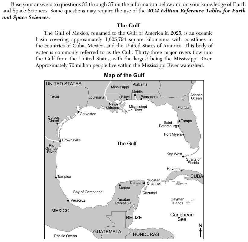
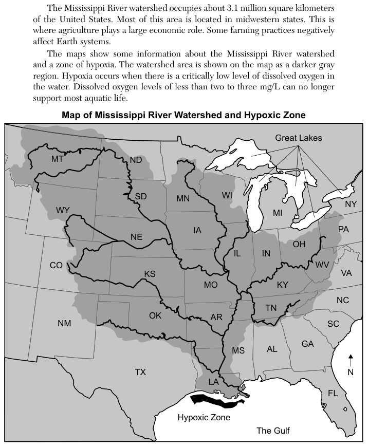
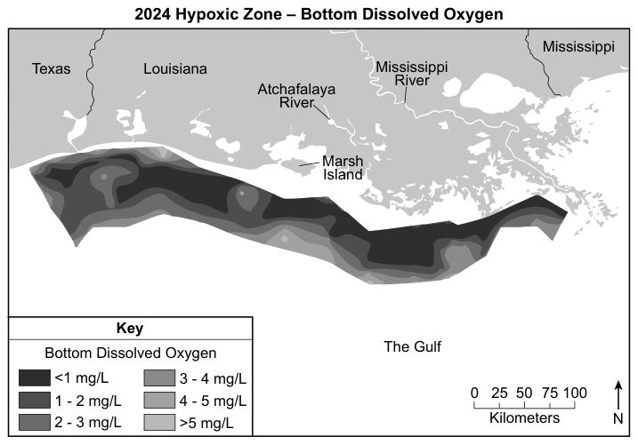
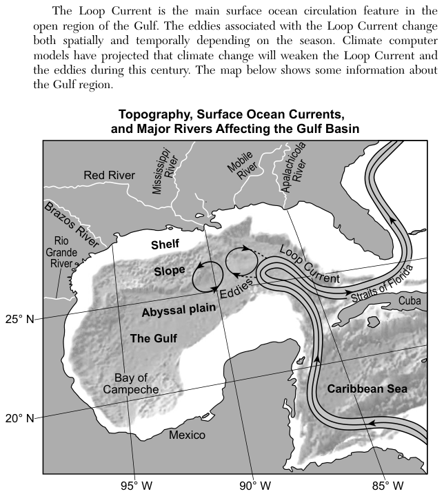
The passage describes the Gulf (the Gulf of Mexico, renamed the Gulf of America in 2025), the Mississippi River watershed and a hypoxic zone (an area of very low dissolved oxygen) off Louisiana. A later passage says the Loop Current is the main surface ocean circulation feature in the open Gulf, that its eddies change with place and season, and that climate computer models project climate change will weaken the Loop Current and the eddies during this century. The map, Topography, Surface Ocean Currents, and Major Rivers Affecting the Gulf Basin, shows the Loop Current entering from the Caribbean Sea, looping north into the Gulf and leaving through the Straits of Florida, with two circular eddies beside it near the slope. It also labels the shelf, the slope and the abyssal plain.
How to think about it
Use the stem, which calls the Loop Current warm. Ask what a warm current does for the water it flows into, and what would change if less of that flow arrived. Then look at the map to see what the eddies are attached to, and use the passage to see what is predicted for them.
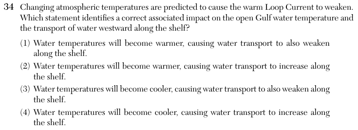
Changing atmospheric temperatures are predicted to cause the warm Loop Current to weaken. Which statement identifies a correct associated impact on the open Gulf water temperature and the transport of water westward along the shelf?