Earth and Space Sciences Regents, August 2026, question 31
Tap an image to open it full size.
What the figure shows
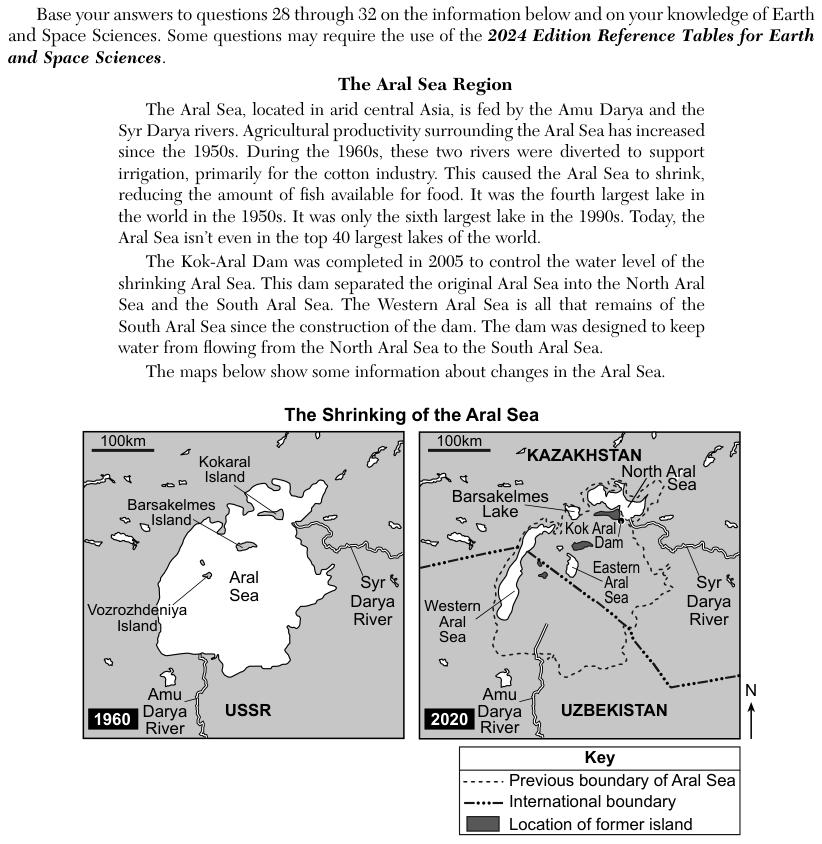
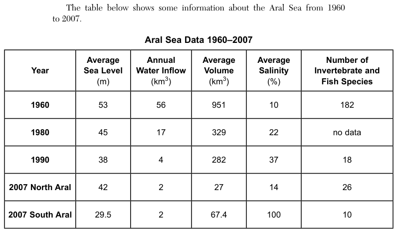
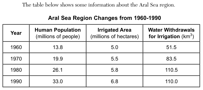
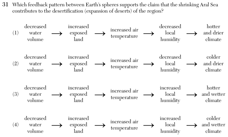
The passage says the Aral Sea in arid central Asia is fed by the Amu Darya and Syr Darya rivers, which were diverted for irrigation in the 1960s, so the sea shrank. The Kok-Aral Dam, completed in 2005, split it into the North Aral Sea and the South Aral Sea and was designed to keep water from flowing from the North Aral Sea to the South Aral Sea. A table of Aral Sea data from 1960 to 2007 shows average sea level, annual water inflow and average volume all falling, and average salinity rising, while a second table shows the human population, irrigated area and water withdrawals for irrigation rising from 1960 to 1990. Each of the four choices is a chain of five steps joined by arrows. All four start with decreased water volume, increased exposed land and increased air temperature; they differ in whether local humidity decreases or increases and in whether the final climate is hotter or colder, and drier or wetter.
How to think about it
A desert is a region with very little moisture in the air and little rain. Follow each chain one arrow at a time and ask whether each step leads to the next one. Think about where the moisture in the air over a region comes from, and what happens to it when a large body of water shrinks.
Which feedback pattern between Earth’s spheres supports the claim that the shrinking Aral Sea contributes to the desertification (expansion of deserts) of the region?