Earth and Space Sciences Regents, August 2026, question 13
Tap an image to open it full size.
What the figure shows
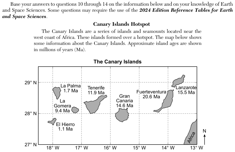
The passage says the Canary Islands region has relatively low average annual rainfall compared with other tropical locations. A map earlier in the set places the islands between 27 degrees N and 29 degrees N latitude, off the west coast of Africa. Each choice names a type of air motion (rising or descending), the circulation cells or jet stream involved, a pressure zone and a climate.
How to think about it
Find the latitude of the Canary Islands on the map. Then open the Model of Generalized Planetary Wind Belts in the Troposphere and the Cross Section Model of Earth's Lower Atmosphere, and find which pressure belt lies at that latitude and whether air rises or sinks there.
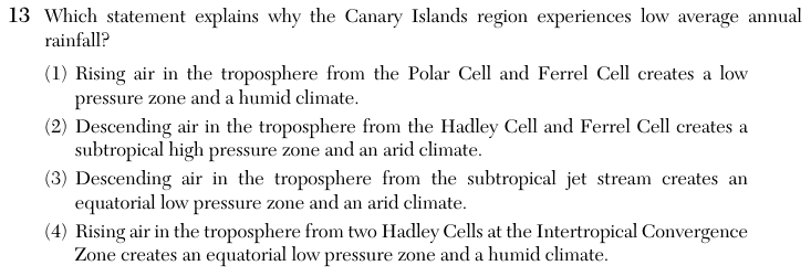
Which statement explains why the Canary Islands region experiences low average annual rainfall?
Choice 2 is right. The Canary Islands lie near 28 degrees N, close to the subtropical high pressure belt at about 30 degrees N. There, air from the Hadley Cell and the Ferrel Cell descends. Sinking air warms as it is compressed, clouds do not form easily, and the climate is dry.
Rising air between the Polar Cell and the Ferrel Cell is found near 60 degrees N, far north of the Canary Islands. Rising air also brings wet weather, which does not explain low rainfall.
The subtropical jet stream does sit high above about 30 degrees N, but descending air makes high pressure, not low pressure. The equatorial low is at 0 degrees, not at the latitude of the Canary Islands. This choice mixes up features from two different latitudes.
Two Hadley Cells meet and air rises at the Intertropical Convergence Zone near the equator. That zone is wet, not dry, and it is about 28 degrees south of the Canary Islands.