Earth and Space Sciences Regents, January 2026, question 24
Tap an image to open it full size.
What the figure shows
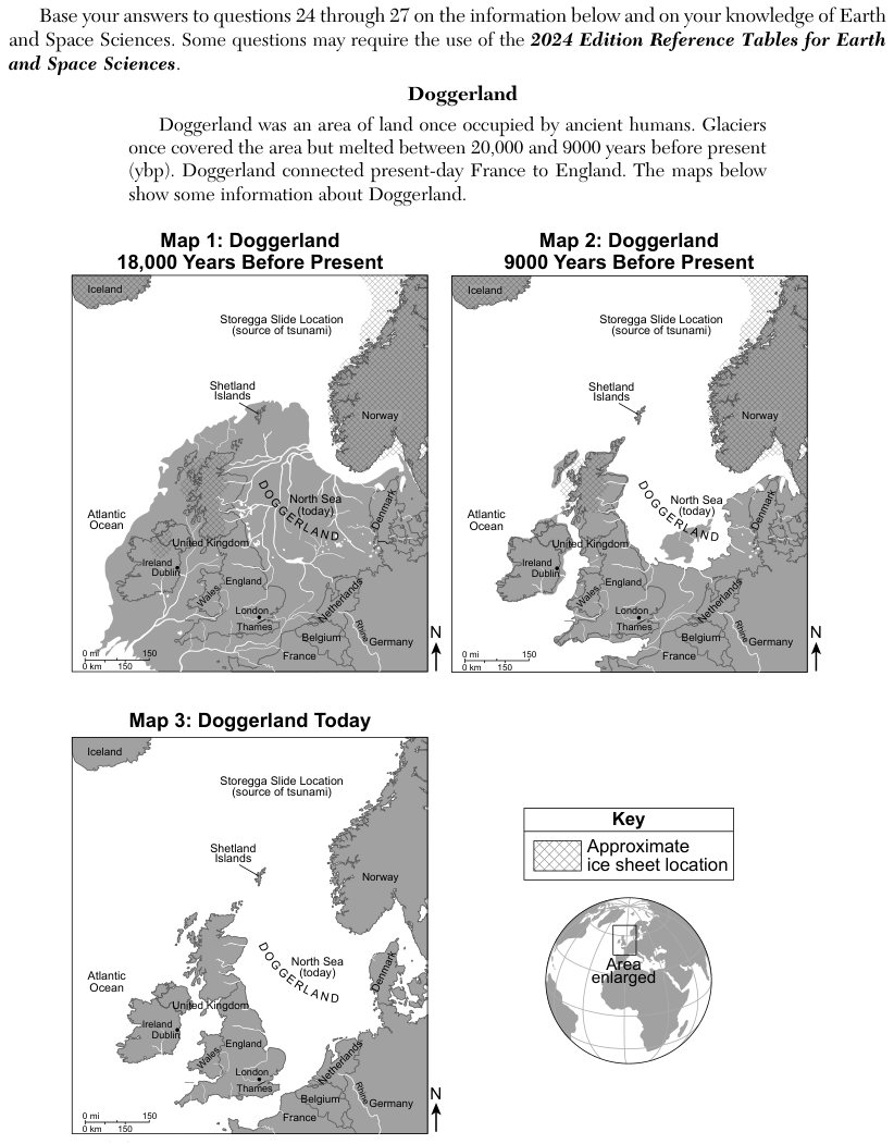
The passage says Doggerland was land once used by ancient humans, that glaciers covered the area and melted between 20,000 and 9000 years before present (ybp), and that Doggerland connected present-day France to England. Map 1 (18,000 years before present) shows a large land area joining Ireland, the United Kingdom and Europe, with an ice sheet over Norway and over part of the northern United Kingdom. Map 2 (9000 years before present) shows less land and less ice, and Map 3 (today) shows Ireland and the United Kingdom as islands surrounded by sea. Dublin is marked on Ireland on all three maps.
How to think about it
Compare the ice sheet and the coastline on the three maps to decide whether the region became warmer or colder. Then open the Surface Ocean Currents Model and find which current flows toward Ireland, and whether it is warm or cold. Think about what a nearby warm or cold ocean does to the moisture in the air.
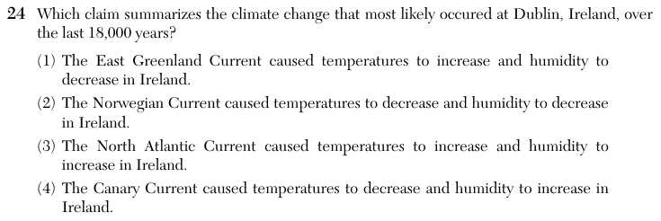
Which claim summarizes the climate change that most likely occured at Dublin, Ireland, over the last 18,000 years?
Choice 3 is right. The maps show the ice sheet melting and the sea rising until Ireland became an island, so temperatures went up. The Surface Ocean Currents Model shows the North Atlantic Current as a warm current flowing northeast toward Ireland and the British Isles. Warm ocean water adds heat and water vapor to the air, which raises both temperature and humidity in Ireland.
The East Greenland Current is a cold current that flows south along the coast of Greenland, far from Ireland. A cold current would not warm Ireland, so it does not explain the rise in temperature that the melting ice shows.
The Norwegian Current is a warm current that flows northeast along Norway, away from Ireland. The maps show ice melting, which means temperatures rose rather than fell.
The Canary Current is a cold current that flows south along the coast of northwest Africa, south of Ireland. The melting ice on the maps shows warming, so a drop in temperature does not fit.