Earth and Space Sciences Regents, August 2025, question 44
Tap an image to open it full size.
What the figure shows
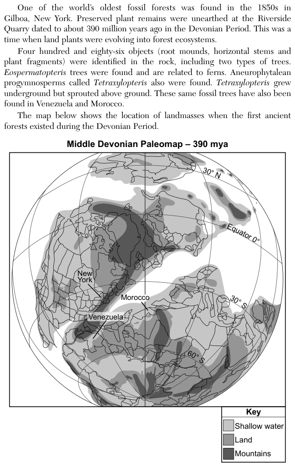
The passage says one of the world's oldest fossil forests was found at Gilboa, New York, in rock about 390 million years old from the Devonian Period, and that the same fossil trees have also been found in Venezuela and Morocco. The Middle Devonian Paleomap (390 million years ago, mya) shows the landmasses on a globe, with latitude lines labeled 30° N, Equator 0°, 30° S and 60° S. Its key shades shallow water, land and mountains, and New York, Venezuela and Morocco are labeled.
How to think about it
The question asks what the map itself can show. A paleomap shows where each place was at that time, including how far it was from the equator. Find the three labels and read their positions against the printed latitude lines and the shading in the key.
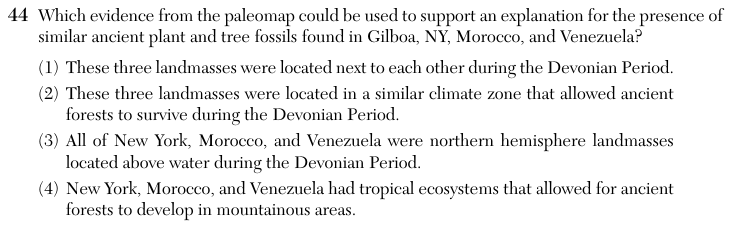
Which evidence from the paleomap could be used to support an explanation for the presence of similar ancient plant and tree fossils found in Gilboa, NY, Morocco, and Venezuela?
Choice 2 is right. On the paleomap, New York, Venezuela and Morocco all sit south of the equator at similar latitudes, near the 30° S line. Places at similar latitudes receive similar amounts of sunlight and share a similar climate zone. A shared climate let the same kinds of early forest trees grow in all three places.
The three labels are near one another on the map, but they mark separate places, not landmasses joined side by side. Closeness alone also does not explain why forests could grow there; the conditions in each place do. This choice may come from noticing that the labels sit near each other.
This choice misreads the latitude lines. All three places lie south of the equator on the map, so they were in the southern hemisphere during the Devonian Period. Today New York, Morocco and Venezuela are in the northern hemisphere, and that present position may be the source of this mix-up.
The map shows land, shallow water and mountains, but it shows no ecosystems, so it cannot be evidence of tropical ecosystems. Nothing in the map or the passage places the forests in mountainous areas. This choice may come from linking the dark mountain shading near the labels to where the forests grew.