Earth and Space Sciences Regents, June 2025, question 8
Tap an image to open it full size.
What the figure shows
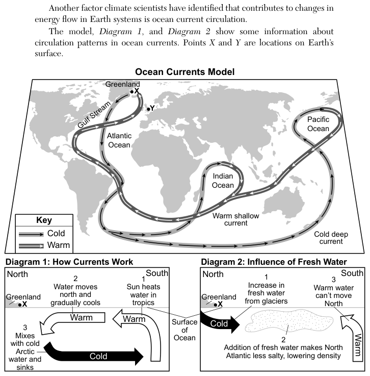
The "Ocean Currents Model" world map shows warm shallow currents and cold deep currents, with a key that marks each type. The Gulf Stream is labelled off eastern North America, and a current continues northeast across the North Atlantic. Point Y is on land in northwestern Europe, east of Greenland. The Surface Ocean Currents Model on page 20 of the reference tables shows the same region in more detail, with each current marked as warm or cold.
How to think about it
Find the surface current that flows along the coast near Y and check in the key whether it is warm or cold. Then think about two effects of the water on the air above it: its temperature, and how much water evaporates from it into the air.
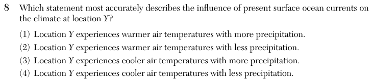
Which statement most accurately describes the influence of present surface ocean currents on the climate at location Y?
Choice 1 is right. The Gulf Stream carries warm water from the tropics northeast across the Atlantic, where it continues as the North Atlantic Current and the Norwegian Current toward northwestern Europe. This warm water heats the air above it, so Y is warmer than other places at the same latitude. Warm water also evaporates more, so the air carries more moisture and brings more precipitation to Y.
The temperature part is correct, but warm ocean water adds moisture to the air through evaporation. That gives more precipitation, not less.
This choice reads the current near Y as cold. The key and page 20 of the reference tables show the current reaching northwestern Europe as warm, so it raises air temperatures.
This choice describes a coast beside a cold current, where cool water chills the air and little water evaporates. The current reaching Y is warm, so both parts are reversed.